


SAMOSA - Development of SAR Altimetry Studies and Applications over Ocean, Coastal zones and Inland waters
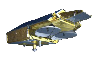
The forthcoming CryoSat2
mission has as its primary goal, the retrieval of data over the cryosphere.
However, there will be sufficient spare resources to allow additional goals of
retrieving data over
parts of the ocean, some inland water and land surfaces. Since these complex targets did not form
part of the initial mission, studies must now be performed to determine how the SIRAL instrument
will perceive these surfaces.
At the EAPRS lab, the possible information retrieval over land and inland water is being investigated, using both theoretical approaches, in-house modelling and the outputs from the CRYMPS software system, which simulates the data retrieval of the SIRAL altimeter.
The ocean studies are led by NOCS. In addition to this a examination of possible contributions from SIRAL to ocean geodesy are jointly being studied by DNSC, Starlab and the EAPRS Lab.