


River & Lake - Combined Timeseries
Using the processing system in the EAPRS lab we are able to obtain detailed timeseries showing the variation in water levels of thousands of targets worldwide.
It is often useful to compare results obtained from different and past missions such as ERS2, Topex, EnviSat and Jason-1 (see the Altimetry missions section for specific mission information). This helps to confirm the measurements, particularly where an unexpected shift has occurred, for example where the previous annual variation has changed due to climate variation, or human intervention has altered the water flow along a river system (e.g. due to dam construction).
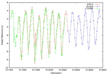
Results from spatially coincident crossings of ERS-2, Topex and EnviSat over the Amazon River.
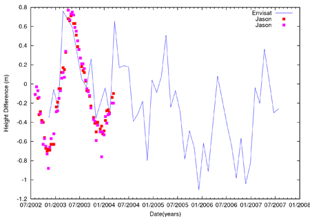
Example over Lake Malawi in Africa showing the simularity between timeseries from two different Jason-1 crossings plotted against EnviSat.
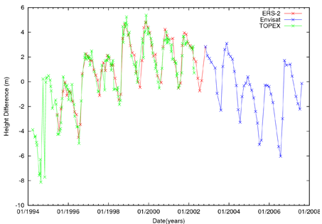
Timeseries of ERS-2, Topex and EnviSat derived heights over Lake Nasser, Africa.