


River & Lake - Next Generation
The system is now being enhanced to increase radically the number of inland water bodies monitored using these techniques, and to improve the accuracy of height recovery.
Data for the Jason-2 mission have been added to the Near-Real-Time system; current targets and statistics are shown below
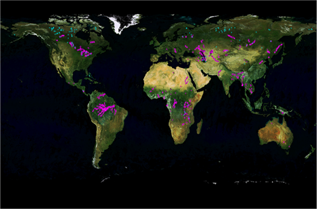
Total targets: 1341 EnviSat: 1229 Jason-2:112
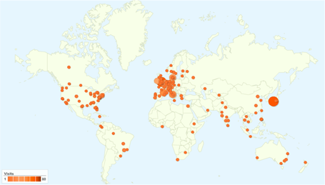
The global nature of this collaborative work is well illustrated using a snapshot from Google Analytics (below) showing the distribution of users at July 2010.
A new aspect of this work is the automated grading system, which allows the quality of derived timeseries to be automatically assessed. Examples for the Amazon basin are shown below for TOPEX, Jason1, ERS2 and EnviSat. Jason2 will be added as soon as a sufficiently long timeseries has accrued.
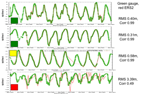
ERS-2
ENVK
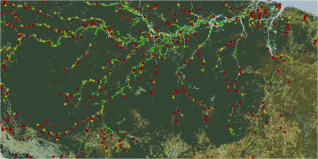
TOPEX
Jason-1
RIVER MODELLING
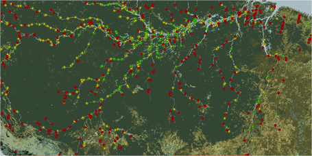
The multi-mission altimeter derived heights are now being incorporated into river modelling systems, with a series of studies with the University of Newcastle upon Tyne, the Technical University of Denmark, and the Danish Hydrological Institute, using several different approaches, to explore the optimal use of this unique resource in directly enhancing river height retrieval, in order to establish the potential for now-casting and short term forecasting for improved resource management, including drought and flood prediction. Results to date are extremely positive, and the Syr Darya system is being run daily, ingesting altimeter data and providing nowcasting information directly to the ESA River and Lake website.